
The River Ranch Hub app
River Ranch Acres in your pocket. Free forever.
Parcel maps, fire and flood alerts, trail recording, road reports and your neighbors. Open it in your browser or add it to your home screen.


Runs free in your browser too. No download, no account.
Scan to open it
- Free, forever
- GPS tracking with no signal
- Works in any browser
- No account needed
Get it today
Free on iPhone and Android
Tap the badge for your phone. On a computer, scan its code with your phone’s camera.
iPhone
GoHubs is free on the App Store. No account needed to start.
Android
GoHubs is free on Google Play. No account needed to start.
On a computer? GoHubs runs in your browser too. No download, no account.
In the field
See it in action
The four screens landowners actually open out here, on one bar of signal or none at all.
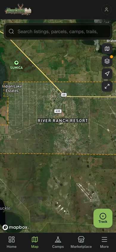
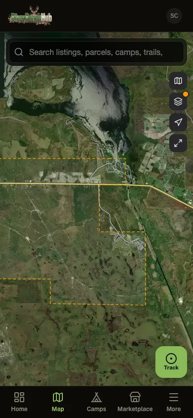
Parcel maps
Know exactly where your lines are
Every lot in River Ranch Acres from the Polk County GIS, with the camps, trails, and listings around it on the same map.
Free parcel boundaries
Look up any lot without a $99/yr parcel subscription.
Camps and trails
Neighbors’ camps and named community trails, mapped.
Land and auctions
Land for sale and tax-deed auctions pinned where they are.
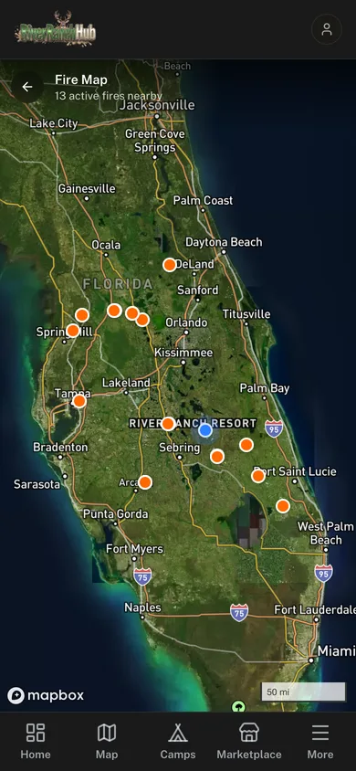
Fire watch
Know about the fire before you smell it
There is no fire department out here. NASA satellite fire detection runs around the clock and pushes an alert the moment heat shows up near your land.
Always-on satellite watch
NASA FIRMS scans for thermal hotspots 24/7.
Alerts near your lot
Distance and direction at a glance, not a statewide map.
Neighbor smoke reports
What people out here are seeing right now, layered on top.
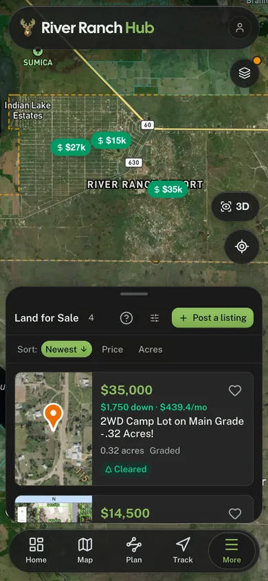
Land for sale
Every lot for sale, on the map
Lots for sale in River Ranch Acres sit on the map where they really are, each with its price, acreage and terms. Selling one? List it from the app.
Priced on the map
See what a lot costs before you drive out to look at it.
Terms up front
Down payment and monthly figures, where the seller lists them.
List your own
Post your lot from the app, with photos and the details buyers ask about.
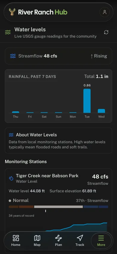
Water levels
Know if the roads will be under water
Low ground floods out here. The app reads the nearest USGS stream gauge and the past week of rain, so you know before you load the truck.
Live USGS gauges
Streamflow and water level, and whether it is rising or falling.
A week of rain
Daily rainfall totals, so a wet week is no surprise.
Against the record
Today’s reading next to the station’s own decades of history.
The toolkit
What ends up on your phone
One free install, all of it, for every landowner, renter and guest in River Ranch Acres.
Fire Alerts
NASA satellites watch for heat out here around the clock, and smoke reports from your neighbors come in on top of that.
Trail Recording
Records with no bars at all. Every track you save goes onto the community trail map.
Group Ride Tracking
Share a code and everybody shows up on the same map, moving. No Polaris subscription to do it.
Road Conditions
Color-coded reports from whoever just drove it. Know what is passable before you load the trailer.
Community Chat
Announcements, gate codes and weekend plans in one place instead of six Facebook groups.
Your Camp Profile
Claim your parcels, put up photos, list what you have got out there. Let the neighbors see what you built.
Community Photos
A shared feed for everybody out here. Post what the trails look like today.
Compare
Free, next to the ones that charge
LandGlide, Regrid and Land id want about $99 a year for lot lines. Here is that same lookup for nothing, next to everything else River Ranch Hub throws in.
| Feature | River Ranch Hub Free | Regrid | LandGlide | Land id |
|---|---|---|---|---|
| Price | Free | From $99/yr | ~$99/yr | From $99/yr |
| GPS Parcel Maps | ||||
| Parcel Boundaries | ||||
| Owner & Contact Data | Free | Paid add-on | Paid | Paid |
| Full Area Coverage | Partial | Paid | Paid | |
| No Account Required | ||||
| Trail Recording | ||||
| Group Ride Tracking | ||||
| Fire Alerts | ||||
| Water Level Data | ||||
| Community Chat | ||||
| Camp Profiles | ||||
| Local Services Directory | ||||
| Community Marketplace | ||||
| Road Condition Reports | ||||
| Community Photo Feed | ||||
| Gate & Access Management |
FAQ
Before you install
Get the app
Open River Ranch Hub
No account to look at the map, no card, no subscription. Open it and River Ranch Acres is right there.
- Free forever. No subscription, no ads, no catch
- Fire and flood alerts reach every phone in River Ranch Acres
- Trail recording keeps working where the signal does not
Runs free in your browser too. No download, no account.